1. Why India, why now
Three forces are converging in India that make transparent, open forest valuation a need rather than a nice-to-have:
- CCTS goes live in 2026. India's Carbon Credit Trading Scheme (overseen by the Bureau of Energy Efficiency) is operational. Afforestation is one of the approved offset methodologies; voluntary registration is open to forest projects.
- Water stress is no longer regional. Bengaluru's intermittent water-rationing, Chennai's Day Zero memory, and the chronic Cauvery–Krishna disputes are all upstream-forest stories at heart. ITC, Coca-Cola, Hindustan Unilever, Infosys, and other water-intensive companies have all begun publishing watershed strategies.
- Disclosure pressure is global. TNFD adoption is moving fastest among multinational ESG investors, and Indian operations are part of the consolidated balance sheet that gets disclosed. Whether a company is headquartered in Mumbai or Tokyo, its Indian footprint needs to be measurable.
The technology that makes this measurable already exists and is free: Sentinel-2 covers India 2–3 times per week, NASA POWER provides global climate forcing, and the Forest Survey of India (FSI) maintains a national inventory comparable in role to Japan's Forest Ecosystem Survey.
2. Why Western Ghats is the right first pilot
For a first-site selection, we want a region where (a) the public-good function is large and measurable, (b) downstream beneficiaries are concentrated and economically significant, and (c) public data coverage is dense. Western Ghats checks all three.
Length
≈ 1,600 km
Gujarat → Kerala / Tamil Nadu
UNESCO sites
39
Biodiversity hotspot, 2012
Major rivers fed
≥ 6
Krishna · Godavari · Cauvery · Periyar · Tungabhadra · Sharavathi
Downstream pop.
~300 M
Karnataka · Tamil Nadu · Andhra · Kerala · Maharashtra
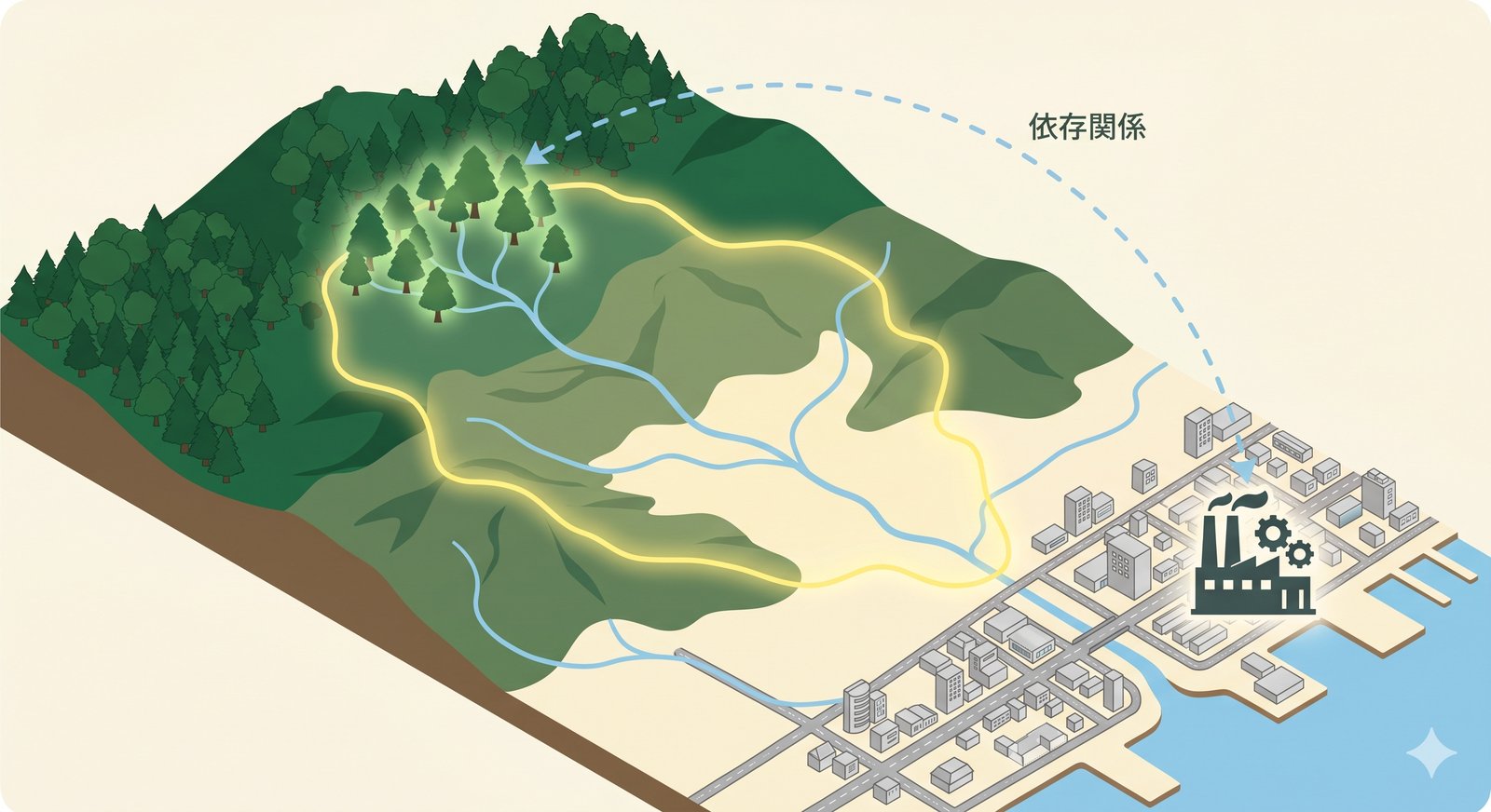
The Cauvery basin alone provides drinking water to Bengaluru, Mysuru, and Chennai. Its upstream catchment in the Kodagu / Wayanad portion of the Western Ghats is intensely studied — and intensely cultivated for coffee, cardamom, and pepper. These tree-cover supply chains are also the corporate ESG hooks: every cup of Karnataka coffee implicitly depends on a measurable watershed.
3. What stays the same, what swaps in
The architecture is unchanged. Only the regional reference layers swap.
Stays identical (already global)
- Sentinel-2 L2A (NDVI, weekly observation) via Copernicus / AWS Open Data
- Sentinel-1 SAR (cloud-penetrating, monsoon-resilient)
- NASA POWER climate forcing (precipitation, temperature)
- HydroBASINS Lvl 10 watershed boundaries (CC-BY)
- IPCC AFOLU Tier 2 formula for CO₂ absorption
- TPM 2.0 + Merkle hash + RFC 3161 cryptographic monitoring chain
Swap for India
- FSI inventory (Forest Survey of India, India State of Forest Report) replaces Forest Ecosystem Survey
- IMD (India Meteorological Department) data supplements NASA POWER for higher-resolution rainfall
- Bhuvan / WRIS (India-WRIS) for finer river network and elevation
- CartoSat-1/2 DEM (ISRO) replaces GSI elevation API
- CCTS afforestation methodology replaces Japan's J-Credit FO-001/002/003
- Compensatory Afforestation Fund (CAMPA) project list replaces J-Credit registry
Notably, the forest stand-age and species-mix coefficients are different (teak vs. cedar, sal vs. cypress, evergreen tropical vs. temperate). FSI publishes regional volume tables; these slot directly into the same Tier 2 formula.
4. A worked example: a hypothetical Cauvery-basin Karnataka factory
Suppose a beverage manufacturer operates a bottling plant near Mysuru, drawing from the Kabini reservoir. Walk-through:
- Locate the watershed. Mysuru → HydroBASINS Lvl 10 basin ID → trace upstream through the Kabini sub-catchment to the Brahmagiri-Bandipur range in Kodagu / Wayanad.
- Mask the forest pixels. Two seasonal Sentinel-2 composites (pre-monsoon dry, post-monsoon green) classify pixels with NDVI > 0.5 as forest. Western Ghats canopy NDVI typically peaks at 0.78–0.92 post-monsoon.
- Estimate CO₂ absorption. Apply Tier 2 with FSI's evergreen tropical coefficients: roughly 15–22 t-CO₂/ha/yr for mature semi-evergreen stands (higher than Japan's 8–10 t-CO₂/ha/yr for sugi at age 40).
- Estimate water yield. Apply the water-balance approach with IMD precipitation (Kodagu averages 2,500–4,000 mm/yr in monsoon, far above any Japanese pilot site) and Bhuvan elevation. Forested upstream area typically yields 900–1,800 mm/yr of recharge after subtracting direct runoff and evapotranspiration.
- Cross-reference CCTS-eligible projects. Check whether any CCTS-registered afforestation or forest-management project sits within the traced basin. If yes: surface those projects to the user as supply-chain-aligned offset candidates.
- Issue the report. A signed report (TPM attestation + RFC 3161) with watershed maps, NDVI history, water-yield estimate, CO₂ estimate, and credit candidates.
The output looks structurally identical to our Himi (Toyama, Japan) pilot — only the numbers, the species, and the regulatory anchor differ.
5. What CCTS specifically wants vs. what morimieru provides
| CCTS / Compliance need | Where morimieru fits |
|---|---|
| Baseline NDVI / canopy cover at project registration | Sentinel-2 multi-year mean, openly verifiable, with cryptographic timestamp |
| Annual MRV (Monitoring, Reporting, Verification) | Year-over-year NDVI diff + forest area change + Tier 2 recalculation. Per-project cost can drop to ~₹50K–₹200K/yr using free satellite data |
| Leakage / additionality check | Regional NDVI trends as control; cryptographic chain proves baseline wasn't backdated |
| Spatial accuracy of project boundary | 10 m Sentinel-2 grid; finer with India CartoSat or LiDAR where available |
| Co-benefit narrative (water, biodiversity) | Water-yield estimate via simplified balance method; vegetation type via NDVI + FSI overlay |
6. The honest gaps (what we cannot do on day one)
We want to be specific about what does not automatically transfer from Japan:
- Species-specific volume tables. FSI's regional tables exist, but the standard coefficients in our pipeline are calibrated for Japanese sugi/hinoki/broadleaf. The replacement is a one-time mapping exercise (a few hundred entries per state), not a research project.
- Stand-age inventory. FSI's India State of Forest Report gives state-level summaries but not stand-level age polygons comparable to Japan's shinrin-bo (forest ledgers). We compensate with NDVI maturity proxies and CAMPA project metadata where available.
- Geology layer. India's Geological Survey of India (GSI) maintains a Bhukosh portal, but seamless coverage at the resolution of Japan's AIST Seamless Geological Map varies by state. Water-yield estimates start with regional defaults and refine where data exists.
- LiDAR. Japan has 80%+ LiDAR coverage of public forests. India has selective LiDAR coverage (Karnataka and parts of Uttarakhand are ahead). Where it exists, we ingest it; elsewhere, Sentinel-2 alone delivers Tier 2 accuracy.
None of these gaps are blockers. They are calibration tasks, not architectural changes.
7. Sample pilot scope (a 90-day roadmap)
| Phase | Days | Output |
|---|---|---|
| 1. Site selection | 1–10 | Lock pilot polygon (e.g. 30 km × 30 km in Kodagu / Wayanad) |
| 2. Data assembly | 11–25 | FSI vector + IMD grids + Bhuvan DEM + Sentinel-2 5-year history loaded |
| 3. Calibration | 26–45 | Tier 2 coefficients for Western Ghats evergreen / semi-evergreen / moist-deciduous |
| 4. Public dashboard | 46–65 | India version of /en/map.html centered on Western Ghats |
| 5. Sample report | 66–80 | One signed water-yield + CO₂ report for the pilot polygon |
| 6. CCTS bridge | 81–90 | Compatibility note & data export format for CCTS afforestation methodology |
8. How to engage with us
We are not a vendor. morimieru is a public-good infrastructure operated by M-square Lab Inc., a Shizuoka-based research and product company. We are looking for:
- Pilot partners with a credible Western Ghats footprint (a forest department, a research institution, or a company with a stake in the watershed).
- Data-sharing collaborators who can open up FSI plots, CAMPA project boundaries, or state-level LiDAR.
- Indian sustainability teams who want their CCTS or TNFD disclosure backed by transparent open-data measurements, not black-box consulting.
Everything we publish stays free. Everything we calculate is reproducible. Every report is cryptographically verifiable.
9. Frequently asked questions
- Q1. Is morimieru registered with CCTS as a methodology developer?
- Not yet. The current platform is a measurement layer, not a methodology. Our values feed into CCTS-registered afforestation projects as MRV evidence — they do not replace CCTS registration itself.
- Q2. How accurate are the numbers for India compared to Japan?
- Tier 2 accuracy (±10–30%) is achievable in India as soon as FSI species coefficients are mapped in. Higher-precision Tier 3 requires LiDAR or on-site mensuration, which we ingest where states have published it.
- Q3. Can a forest department use morimieru to monitor compensatory afforestation under CAMPA?
- Yes, as a parallel monitoring layer. The cryptographic chain means a state's monitoring report cannot be back-edited, which is valuable for inter-state and CAG audits.
- Q4. Does morimieru handle Sentinel-2 cloud cover during India's monsoon?
- The pipeline already combines pre-monsoon and post-monsoon composites and falls back to Sentinel-1 SAR (cloud-penetrating) for continuity. Monsoon gaps are a known issue but not a blocker for annual MRV.
- Q5. What does it cost?
- Use of the public site is free. A custom India deployment (a Western Ghats pilot dashboard plus calibration) is the conversation we want to have with a partner organization.
10. References & sources
- Bureau of Energy Efficiency (India) — Carbon Credit Trading Scheme (CCTS) framework, 2024–2026
- Ministry of Power, Government of India — 8 approved voluntary credit methodologies, March 2025
- Forest Survey of India — India State of Forest Report (latest biennial edition)
- India Meteorological Department — gridded precipitation and temperature data
- ISRO Bhuvan — CartoSat DEM, land-use / land-cover
- India-WRIS — Water Resources Information System portal
- Copernicus Sentinel-2 / Sentinel-1 — open satellite data via AWS Open Data
- NASA POWER — global meteorological forcing
- WWF HydroSHEDS / HydroBASINS — global watershed boundaries (CC-BY)
- IPCC 2006 Guidelines for National Greenhouse Gas Inventories, AFOLU Volume 4 (2019 Refinement)
Last updated 2026-05-26. India CCTS implementation details continue to evolve; we will revise as the Bureau of Energy Efficiency publishes finalized methodology rules.