 morimieru
forest valuation
morimieru
forest valuation
morimieru
forest valuation
morimieru
forest valuation
Find your connection to forests
Free public satellite data, transparent calculations, instant valuation of any forest's
water yield, carbon absorption, and downstream connection — at watershed and stand precision.
Built entirely on free open data —
Sentinel-1/2, Landsat, NASA POWER, IPCC AFOLU Tier 2, HydroBASINS.
About
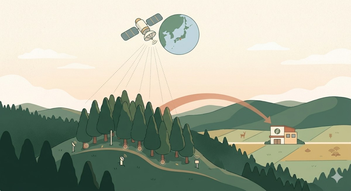
Sentinel-2 and Sentinel-1 (European Copernicus) observe every site on Earth 2–3 times per week. The pilot computes real NDVI from free L2A tiles via AWS Open Data — no proprietary feeds.
The current Japan pilot maps all 264 forest-management projects registered with the Japan J-Credit programme. For India, the same approach plugs into India Carbon Market projects and FSI inventory.
Every acquisition, processing, and estimation step is sealed with TPM 2.0 attestation, Merkle hashes, and RFC 3161 timestamps. Reports are independently verifiable by any third party.
Step 1
We propose forests that match your context — your watershed, sector, budget, and intent. Open to companies, governments, and individuals.
Step 2
Click any forest to view its actual satellite image, NDVI history, and absorption estimate.
Your watershed
—
The light-blue boundary is your direct catchment; deeper blue is upstream. See the map below.
Step 3 — Deep dive
A pilot site for the Forestry Agency of Japan's FY2025 evaluation programme. We combine high-precision airborne LiDAR baselines with weekly Sentinel-2 imagery.
5-year NDVI history (weekly observations)
Estimated annual CO₂ absorption
1,420 t-CO₂/yr
95% CI: 1,180 – 1,690 t-CO₂
Estimated annual water yield
— m³/yr
Per Forestry Agency of Japan simplified method Ver.1.0
Credit valuation
17.05 M JPY/yr
@ ¥12,000 / t-CO₂ (recent J-Credit forest-origin market price)
Forest profile
Reference inventories
Step 4
Your commitment has been sealed with a cryptographic timestamp.
Anyone can later verify, with third-party tooling, that this content was decided at this moment.

FOREST COMMITMENT CERTIFICATE
森林コミットメント証明書
Sample Corp. hereby commits to the
conservation and stewardship of the forest below.
| Target forest | Asahi range, Himi City, Toyama, Japan |
|---|---|
| Area | 182 ha |
| Est. annual CO₂ absorption | 1,420 t-CO₂ (95% CI: 1,180 – 1,690) |
| Commitment period | 2026-05-13 to 2031-05-12 (5 years) |
| Annual budget | ¥3,000,000 |
Tamper-proof record
※ This certificate is a declaration of intent. It is not itself a carbon credit. Formal credit issuance follows the relevant national methodology (J-Credit in Japan, India Carbon Market in India, etc.).
Reports
Auto-generated reports from satellites and public data, organized by region and topic.
Technology
Sentinel-2 (optical, 10 m resolution, 2× weekly), Sentinel-1 (SAR, all-weather, 1–2× weekly), and Landsat 8/9. Most points on Earth get at least one usable observation per week.
In Japan, 25 years of Forest Ecosystem Survey (15,000 plots on a 4 km grid) and 80%-coverage airborne LiDAR train the estimator. Equivalent reference data (FSI in India, FIA in the US) plugs in the same slot.
TPM 2.0 attestation (time of acquisition) + Merkle hash chain (processing pipeline) + RFC 3161 timestamps make every monitoring report independently verifiable.
All inputs are free data; all code is open-source. Small forest cooperatives and local governments can run it. We compete on verifiability × accessibility, not on proprietary precision.
Articles
Practical guides aligned with public materials (Forestry Agency of Japan, IPCC, TNFD). Aimed at sustainability teams, public-sector officials, and forestry practitioners. Currently in Japanese — English translations coming soon.
India · Semiconductor · NEW
India fabs × water exposure: TNFD / BRSR / CDP playbook — EN
India · Coffee · EUDR
Karnataka coffee: satellite watershed evidence for EUDR / CCTS / TNFD — EN
India · Pilot
India forest valuation pilot: CCTS, Western Ghats & FSI — EN
GX-ETS · 2026
Japan's GX-ETS and forest J-Credits, 2026 edition (the ¥4,300 cap effect) — JP
Water · Guide
Forest water yield: a complete guide to the simplified method — JP
TNFD · Forest
TNFD forest disclosure: a practical guide (LEAP) — JP
J-Credit · Map 2026
All 264 Japan forest J-Credit projects, mapped — JP
Satellite · CO₂
Satellite × forest CO₂: IPCC AFOLU Tier 2 walkthrough — JP